Sunday, April 29, 2012

Ride Report – 2012 Cape Fear 1000

This year’s Cape Fear 1000 was held on Friday and Saturday, 20-21 April 2012. Registration for this annual (and east coast season-opener) long-distance endurance rally is extremely competitive. I wrote earlier about my experience in getting registered for this year’s event (truly an exercise in you-snooze, you-lose).

For new readers, here are a couple of previous ride reports that provide a little insight into what a long-distance endurance rally is: 2011 Void Rally, 2011 Mason Dixon 20-20 Rally.

Having successfully completed the initial registration process, I was left with prepping my bike, getting enough riding in over the winter and early spring, and doing some practice rides.

Connie Custer graciously accepted my invitation to ride with me – this was to be her first long distance ride (previous rides had been in the 250 – 350 mile per day range) and her first rally (i.e., first time riding “on the clock”). The practice rides over the month before the rally focused on getting our fuel and bonus stop timing down – these rides did a great job of getting us into a “battle rhythm”: make the approach, side stand down, jump off the bike, prep whatever needed to be done, jump back on the bike, restart the engine, and safely get going in the right direction for the next bonus. In the spirit of “Bottom Line Up Front” (BLUF), Connie is a natural rallier and a great competitor, and was a huge contributor to our safe and immensely fun ride.

So, on to the details.

I was VERY fortunate to have been able to register for a Jamestown start. We left Northern Virginia on Thursday to give us time for a nice ride north, stopping off in Bedford, PA for a post office photograph:

and a very nice lunch.

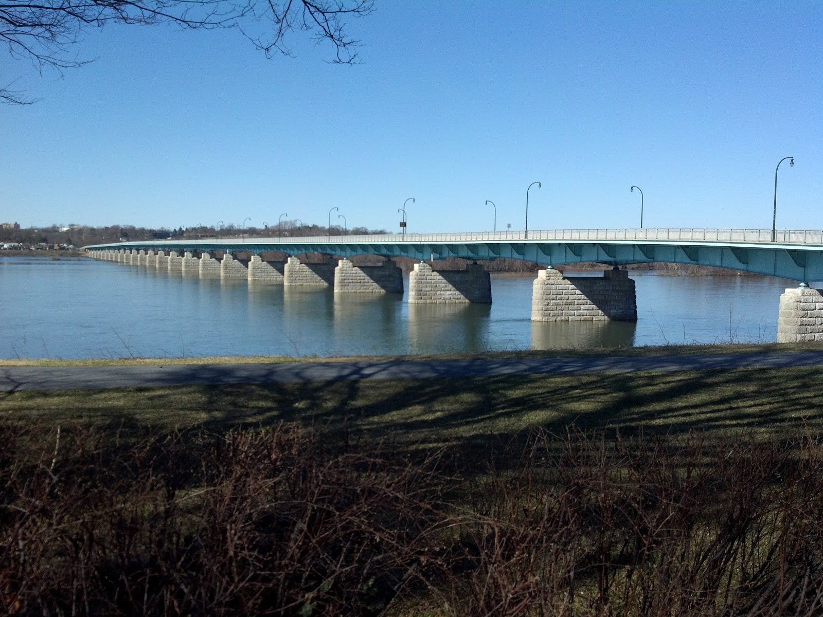
Here’s our track on Thursday:

image

We took a little detour at the end of the day to capture a photograph of the Chautauqua, NY post office:

Then, we were on a mission to find some food. Chautauqua is a ghost town for ten months of the year (we were there during the ghost town phase), so we headed back to Jamestown. Jamestown, NY is not in the “happenin’ places” category – we did a bit of riding around until we found (a) Mexican place, and (b) a Mexican place with two rally bikes parked out front. The food was everything I expected from a Mexican place in Jamestown, NY. Sufficiently nourished, we needed north through town to the Hampton Inn and Suites, where I put a few finishing touches on the plan and went over the whole route with Connie. I’d had some real “fun” with the rally book the night before (finishing with map making some time after 0100), so I needed the opportunity to take a few more glances at the bonii and routing options before we headed out in the morning.

We selected one route for the first half of the rally (the time from the Jamestown launch about 1000 Friday to our arrival at the odometer check on I-40 in North Carolina, which was to be about 23 hours later), and three options for the second half of the rally (the period from the end of the odometer check to the deadline end of the rally at 1500 Saturday.

Connie got our starting receipt at 1007, then we headed out.

image

Road conditions were great, and the temperatures were pleasant (considering it was late April near Lake Erie). As it turned out, we were VERY fortunate not to be leaving just a couple of days later, when Jamestown received a foot or more of snow. That would have really put a damper on our rally plans!

Our first stop was in Andover, OH at the site of the Andover Bank Time Capsule. We hadn’t been on the road long enough to spread the arrival time of the riders who had elected to take this route, so there were a lot of bikes parked around the bank. We got our picture, saddled up, and continued south.

DSCN0092

Our next stop was the Quaker Steak & Lube in Sharon, PA where we had to snag a receipt. Connie deftly dealt with the crowd of fellow ralliers, got our receipt, and we were off to our next stop.

We skirted Youngstown, OH….

image

image…enroute Carrolton, OH where we were to find a particular sign. Lots of riders milling about looking for the sign, and Connie made the save. It didn’t take long for other riders to figure out that Connie was on to something, so we got our assigned photograph and headed south.

DSCN0093

We stopped by Clark Gable’s birthplace to get take the required photograph. Note the sky – this was a beautiful day for riding (good thing we had sunscreen along!).

DSCN0095

Then, we had a long ride south, into West Virginia,

image

image

to Looneyville, WV. The road to Looneyville was a great set of twisties (typical back-road West Virginia) – we were fortunate that we didn’t have to do this road in the dark or in bad weather, so we were able to enjoy the whole ride.

DSCN0097

Our next stop was in Virginia, so we headed south again.

imageIf you look closely around Bradley, WV you can see the first time error of the trip – I got off the WV Turnpike and went too far for gas. That cost a few critical minutes of our timeline. We had been running exactly on plan all day, but costly mistakes like this consume valuable minutes.

image

And there’s another time-wasting mistake around Wytheville, VA where I misread a ramp sign and got going the wrong way on I-81 (got to go north on I-81 to go south on I-77 don’cha know!

image

We departed I-77 enroute Stuart, VA – although it was getting dark, the ride was beautiful. This part of Virginia is high on the list of places to go for more leisurely riding. We had a Confederate memorial to find in Stuart. It’s a very nice small town, and the weather was such that there were a few people just hanging out, watching us run around taking pictures.

DSCN0100

image

Our next stop was Speedy’s Barbecue, Inc in Lexington, NC.

DSCN0105

From Lexington, we headed south to Albemarle, NC. The mandatory rest period window opened at 0000 Saturday, and we needed to have a receipt from anywhere in Albemarle, NC so it made sense to do the entire rest in Albemarle. We had fallen behind plan, to the point where we arrived in Albemarle about 0020. I hadn’t made reservations in Albemarle as one of our rallying pals had, so that cost some time while we looked for somewhere to stay. I got the clock stopped and rest stop started about 0045 (after some fun trying to find fuel at that hour) – that delay was very costly (50 points / minute!).

We each got some good sleep, then got going in the morning, starting the clock again a little after 0600 at the Walmart gas station across the street from the hotel. From Albemarle, we headed to Ellerbe, NC

image

where we snapped a picture of some figures out in front of the Inn at Ellerbe Springs.

DSCN0106

Carthage, NC was next on our list, where we stopped by to see an old time sign on the side of the [former] Cornwallis Service Station (where corner gravel is featured prominently).

DSCN0107

Now, we were off to do the odometer check and participate in a Time-Distance-Speed test (the goal was to finish as closely as possible to the mean speed along the odometer course). We had a bit of a routing challenge during the odometer check, so we got to do it twice, but we came in 2 seconds below the mean on the T-D-S challenge, so we got the maximum number of points (7500).

We had worked out three alternative routes to take after the odometer check. We were a little late getting out of the check, so we selected the route that we had planned in case that happened.

image

In the spirit of routing mistakes, I blew another turn (that I didn’t realize until much later) – I was supposed to take the short blue route to the east, but since I missed the turn, I got to go quite a bit further south on the freeway, before turning north again to our next stop. We had plenty of margin on this route, so this mistake wasn’t nearly as costly as it would have been if we were on a route with a tighter margin.

This is a lighthouse in a small pond in back of a gas station in Pink Hill, NC (note: we couldn’t see anything that remotely resembled a hill in Pink Hill).

DSCN0108

After Pink Hill, we headed north to Kinston, NC to locate the CSS Neuse. This was one of the big point bonus locations that we wanted to get, and we did.

image

DSCN0109

We had enough margin remaining in Kinston that we got some water and got a quick bite to eat. From Kinston, we had a straight shot south to Surf City, NC to visit Skully the Pirate.

image

There wasn’t anyone else around, so I knew I had to use the tripod. Good plan – poor execution, since you can’t read our number using this resolution on the camera. Next time, park closer and use the max resolution allowed by the rally rules.

DSCN0111

After Surf City, we had a leisurely ride down U.S. 17 to our penultimate stop – the convenience store across the street from the rally headquarters. Our mission: obtain adult beverages that could be safely carried on the bike across U.S. 17. We got to the finish line safe, and sound, with beverages in hand in plenty of time to stop the clock. There were bikes everywhere – about 120 or so.

We got scored okay, and got ready for the post-rally banquet (which was BBQ and GREAT). We were both pretty tired after riding much of the previous three days, so each of us turned in to get a little shut-eye before getting ready to head back to Northern Virginia.

We rode about 1140 [uncorrected] miles in 29 hours on the clock – not too bad – just about my historical average speed over ground for all trips, on the clock and not.

The weather report for Sunday was predicting a lot of rain all up and down the eastern seaboard. It wasn’t raining when we left Wilmington, but it sure looked like it was going to rain any minute. We got a few sprinkles on the way north, but the ride was otherwise uneventful.

The post office in Maple Hill is on the Big Money Rally bonus list, so we stopped by to take a photograph.

imageThe Smoke Chasing Grand Tour has a mandatory stop in North Carolina. It was closed on Sunday, but the owner was there to greet us – it looks like a great place to eat!

We wound up eating at a nice BBQ place in Cary, NC before getting back on the road heading north.

image

image

I had wanted to stop in the Richmond area to knock out the National Battlefield Park, but the rain was really starting to pick up, and the traffic was getting bad. The rain intensified to the point that we headed north on U.S. 301 to avoid I-95 entirely.

image

image

We had U.S. 301 essentially to ourselves the whole way back to Northern Virginia.

image

We got back safely (if more than slightly soggy) at a decent hour. I dropped Connie off at her place, and I headed back to a heroes welcome offered by Opie and Cinder. We had put nearly 2000 miles on the bike over the four days – a very nice ride!

Epilog. Our objectives for this rally were pretty simple: Finish safely and have fun. We met those objectives handily.

Lessons learned:

* Plan for visor change-over and layer add / removal. Doing this ad hoc is expensive

* If you can’t see the gas station from the road, it doesn’t exist. That’s a lesson that I have a real hard time learning.

* Plan the evening stop ahead – it pays huge dividends to have a reservation. We had plenty of time before we left Jamestown to make a reservation and didn’t. That cost a lot of points and cut down on needed rest.

* Our 3” x 5” card system worked really well – we’ll work on double-checking the data, and making sure we understand the requirements for each bonus location (they’re frequently different, in terms of what must be in each photograph).

* Rain-proof all gear before leaving. It’s easy, and it’s easily forgotten in the planning process.

* Bring heated gear – April can be chilly.

* Build a checklist of stuff to be brought to the scoring table. It’s easy to forget things in the press to be scored, particularly when you’ve been riding a while. This will be really important at Butt Lite 6IX in August, because of the pressures of a multi-day rally.

Thursday, April 19, 2012

2012 Cape Fear 1000

The rally book arrived in my email inbox a little after 1730 today. I couldn't get out of the office until a little after 1910, so I didn't get a good look at it until nearly 2030. Like, apparently, many others, I was entering bonus locations by hand until around 0030 or so.

There are a couple of very promising routes leaving Jamestown...enough to ponder while sleeping this evening....

Monday, March 12, 2012

Ride report -- 9, 10, and 11 March 2012


I got a characteristically late start on Friday, after having a very nice meal. Regardless of how well I pack, it always takes a bit of time to pre-flight the moto-bike and to get all of my cold weather gear on. Given the weather that night, and what I expected on the road, I wore my LD Comfort gear and the Gerbing's [heated] jacket, trousers, and gloves. I had purchased a little ascot-like thing from Aerostich on my last order, so I tried it out, as well (I like it – it keeps the breeze from coming in under my helmet, which keeps my neck warm).


I shoved off about 2130, heading north to Frederick. My route plan had a few BBQ joints (Smoke Chasing Grand Tour) and virtual geocaches, but the chilly air and lateness of hour caused those to fall off the plan in real time – it’s always useful to save a few places for next time!


I got to the Hampton Inn – Harrisburg West about XXXX after an uneventful ride. The temperature was pretty chilly – it dipped to the high 20’s (deg F) at one point, but stayed above 33 deg F for most of the ride.


It turns out that I’ve stayed at that Hampton Inn once before, on a really neat trip to Hershey Park. The hotel lobby has been completely rebuilt in the time between the previous stay and now – it’s very nice.


On Saturday morning, I tried to find a cache very close to the hotel. I thought it was a bit chilly (I didn’t bring a street-clothes jacket on this trip), but figured I could gut it out for the short hike over to the cache (which wasn’t there – DNF). There was a bit of a breeze, so the wind chill was noticeable. When I got back to the hotel, I packed up and got ready to go. The bike thermometer read 33 deg F, so with that slight wind chill, it was below freezing. Small wonder that I thought it was a bit brisk.


I headed in to Harrisburg on a mission to bag the Camp Curtin BBQ and to log the virtual geocaches in town. Harrisburg is a very interesting town. The north part of town is in the post-development, post-blight phase, with many blocks sitting completely idle. Closer to the core of Harrisburg is the state capitol and state government buildings. The area immediately downtown is pretty nice, and there’s a nice waterfront area (at which I dawdled a bit).


And, as promised, here's Camp Curtin Bar-B-Que Station. The area immediately around the Camp needed an influx of capital, but the Camp itself looked just fine. I didn't know how to interpret the CLOSED sign on the door -- it wasn't immediately apparent whether that meant "CLOSED for the day" or "CLOSED forever". 

Camp Curtin (the camp, not necessarily the Bar-B-Que Station) has an interesting history....


Pennsylvania State Capitol:


After Harrisburg, it was time to head southwest. I stopped off to exchange travel bugs at a travel bug “motel”, then continued through Boiling Springs and then southwest through Shippensburg and Chambersburg.


I'd read about this item of "road art", which is located near Shippensburg, so I stopped to take a picture. There's a stretch limo up on stilts at the same location...I save that photograph for next time.


This was my first Waffle House of the day; it's located on Route 11 in Hagerstown, MD:


...and here's Hempen Hill BBQ Bar & Grill (more Smoke Chasing Grand Tour):


 ...and this was my last Waffle House of the day (and of the entire trip):


Note that all Waffle House restaurants look alike...if it weren't for photograph metadata and notes, I wouldn't be able to keep them straight.

I had planned a very ambitious ride for Saturday, and had to shed a few stops to maintain a decent pace. I really wanted to go to Sharpsburg (to get a photograph of the post office), but that detour would have been costly in terms of time, so I kept heading southwest to pick up Interstate 68.

On the way, I needed to get a picture of any sign for the C&O Canal National Historic Park. This isn't the sexiest of signs, but it'll do.


I departed I-68 to head to Little Orleans, MD and Paw Paw, MD – what a trip! 


This isn't the smallest post office I've seen since I've started chasing them (Oriskany, VA fills that bill nicely), but it's pretty close.

Because of the direction from which I was approaching Paw Paw (the north, via Little Orleans), I wound up on some decent gravel roads waaaaay out in the country, right in the middle of a huge state forest. I noticed there were a few caches out there, so decided to go for one in particular. I load up, in the Navigator IV, all the caches along a route on the off chance that I’ll be near something interesting and have a bit of time for exploration. This was one of those opportunities. I wound up finding a cache very close to an interesting site, and skipping the one that attracted me to that side road (it was another 150 meters or so of bushwhacking, which is harder to do when dressed for cold weather).

To say that the location and the view were breathtaking is to take something from the experience. This was definitely a "do 'gain".


I continued southwest to Paw Paw, to get the required post office photograph:


...then headed west to connect up with Interstate 68. I wanted to bag the post office in Ohiopyle, PA, but it was getting dark. By the time I reached the post office, I needed to light up the sign with the high beams, and light up the rally flag with a flashlight. 


Not too bad, eh?

With the sun down, it was getting cold again, and I was ready to get something to eat and grab some z’s. I headed to the Hampton Inn in Uniontown, and grabbed chow at an Italian place across the street.


It was up to 35 deg F on Sunday morning, but the forecast was for a very nice day. I rode through Uniontown in the morning to get an idea of the place (it’s very interesting, in a good way). Uniontown has some connection with George C. Marshall – there’s a nice memorial park in his honor downtown.

I headed to Braddock’s Grave, which is located on U.S. 40, east of Uniontown. U.S. 40 generally follows a colonial-era path / road that later became National Pike. Colonel George Washington led men who built a 12-foot wide “road” through this area to permit the movement of British troops to the Pittsburgh area to defend against French and native attacks on British colonists. A section of this trail / road is plainly visible at Braddock’s Grave, which is really cool.


From Braddock’s Grave, I headed east to Fort Necessity. This is one of the places I need to revisit, to spend some time in the visitor’s / interpretive center.

I've been meaning to spend more time investigating U.S. 40; while riding east, I happened upon this old toll house:


I headed south to get a photograph of the post office at Accident, MD:


...and Archie’s BBQ... 


Continuing south and east, I grabbed Kitzmiller, MD (where I had a very nice, but brief, stop at the Potomac River) then headed into West Virginia. 


The road from Kitzmiller to U.S. 50 has been on my list of roads to ride for a while, now, so it was nice to finally ride it.

I needed to grab a photograph of the post office in Romney, and it was time for a Blizzard™ at the Dairy Queen there, so a stop was in order.

Heading east from Romney, I wanted to make a stop in Unger, WV. The address given at roadsideamerica.com was incorrect (I believe), which caused me to take a long (but exceptionally pretty) detour. Doing a little beside-the-road research on the *directions* to the place told me where the turn was, and I finally found the place, located just north of the West Virginia – Virginia line. 


After I got my pictures, I headed for Winchester, then east on Route 7 to Wolf Trap National Park for the Performing Arts – my last bonus photograph of the trip.


Sunday’s weather was spectacular. The temperature got up to 68 deg F, which was perfect.


All-in-all, it was a wonderful weekend. I was able to see Harrisburg a bit more, and I got to visit a few more places that are now on my “do again” list (specifically Little Orleans, Paw Paw, Ohiopyle, Kitzmiller).


Thursday, March 1, 2012

Sargent Saddle Review -- BMW R1200RT

I've been meaning to write a nice review of the aftermarket R1200RT saddle by Sargent Cycle.

Let's start with a statement of the obvious, and one that I'm sure nearly every R1200RT rider knows. The stock BMW saddle is a plank. That's true of nearly every other stock saddle I've ridden, and the BMW R1200RT is no exception. The stock saddle looks great -- it really fits in with the contours and look of the bike. My hind end refused to appreciate just how great that stock saddle looked, though, and it was time to make a change.

I looked online at a number of aftermarket saddles, and read a lot of reviews. I settled on the Sargent, and ordered it right after I got back from Washington State last summer. The new saddle showed up earlier than promised, and I set about performing the installation. I bought the heated pilot / heated pillion saddle combination. I had to replace the bike's saddle heat connectors, by snipping the original connectors off the bike, installing new backshells, and crimping pins on the exposed wires. Nothing required but a pair of side cutters, a crimping tool, a strong light, and patience. I really took my time, and spent about an hour getting the job done right.

So, aside from the fact that it is electrified, how does it feel?

Well, shortly after I completed the installation, I took it on the road. Where the stock saddle would start to get to me after a few hundred miles, the Sargent kept me solidly in the saddle. In early October, I rode The Void (1200+ miles in 30 or so hours) and felt GREAT. I rode with other folks who were standing on the pegs or nearly sitting side-saddle to relieve pain, and I felt just fine.

I can't say enough about the Sargent, and how it fits me just right. As with anything else associated with long distance riding, your mileage will vary.


Sunday, February 19, 2012

Ride report -- 18 February 2012

This winter has offered some amazing riding weather. I recall last year's first ride was some time in February -- I've been able to ride nearly every weekend so far this year.

I had the bike serviced at Bob's BMW yesterday (24000 mile check, new tires, plus several other things that needed to be done), and the job took a little longer than I had budgeted. Instead of heading out yesterday afternoon, I decided to take the long way home, through the District, and do a little sightseeing. I figured that I'd be able to get out at a decent time on Saturday and would be able to catch up on the riding.

After getting a really good snooze, I was all packed up and ready to head out. The sky was nearly crystal clear (and remained that way almost all day).

It was a nice, and brisk morning. I don't recall seeing the temperature go below this value all morning.
My route had me heading north to Harrisburg, PA via I-495, I-270, and U.S. 15. I'm on the Waffle House Grand Tour, so I stopped by to visit the two Waffle House locations in Frederick, MD to get pictures of my bike, rally flag (er, little serape), and the dining establishment. I was pretty hungry by this time, but didn't want to spoil my lunch by chowing down at the Waffle House.

Waffle House #1666

Waffle House #1555
From Frederick, I headed north to Thurmont, MD -- near the home of the BMW Bikers of Metropolitan Washington (BMWBMW)'s Square Root Rally in Sabillasville, MD. I needed to get a picture of a sign for the Catoctin Mountain Park, and the good folks of the National Park Service didn't disappoint.

I've been here once before, many years ago. The hiking is excellent, and there's a lot of nice history to be seen and enjoyed. I'll be back, when the weather is a little warmer. It's tough to get much walking done when you're dressed like the Michelin Man(TM). I ride on Michelin Pilot Road 2 tires, by the way, but that's not why I feel like the old boy when I ride in the winter.

Catoctin Mountain Park
After that nice stop, I was on to Gettysburg. As you can see, the skies were completely clear. Gettysburg is in a valley, and there was a bit of a breeze, just to keep the temperature crisp. The number of visitors in the battlefield was very light, which was nice for my riding pleasure.

The very nice Visitor's Center is down a road to the right in this picture.
I had a wonderful trip to Gettysburg last year...it was really nice to visit the battlefield and the town again in the winter.

Yes, as you can see, I didn't put the sunscreen on (again).
The Big Money Rally has a nice list of bonus locations, among them National Park System units and selected Post Offices. The Gettysburg Post Office is on the list, so here's my ride, rally flag, and the building.
Gettysburg, PA Post Office
No motorcycle trip would be complete without the opportunity to visit one or more geocaches. This is one that I stopped to find. I managed to find five on this trip, which is pretty good, considering the temperature.

Virtual geocache
 I had wanted to stop by the battlefield (Devil's Den) last October during The Void Rally, but dropped that location when time got tight on the first day. I didn't make it back to Devil's Den on this trip; I saved it for next time (when it's a bit warmer).

I did climb to the top of the tower that looks across the battlefield; I've been by, but never to the top, and knew that I'd get a great shot of Little Round Top.

Little Round Top (left)
 It was getting to be about time to head back to the barn, so I stopped for the virtual geocache at this covered bridge. It was amazing to walk across a bridge this old and well maintained.

Sachs Covered Bridge
And, here I am, back in Northern Virginia, at the end of a wonderful ride....