This is my ride report for the 2011 Mason Dixon 20-20 Motorcycle Rally that was run on Saturday and Sunday, 28-29 May 2011. This was my first long rally; I'd ridden the 500 mile / 10 hour Rally The Void mini-rally last October. Based on that experience, I was looking forward to "getting off the porch and running with the big dogs".
Chronology
Prelude -- registration opened LONG ago...in January, as I recall. I signed up, and anticipated the day when the bonii list would be delivered to my email inbox. The list was originally promised on Friday, 20 May...giving us a week to stew over our routes. As it happened, though, the bonii list was released early, giving us even more time to agonize over potential routes.
Buford, WY (the Ames Memorial) was the obvious sucker's bonus, and I initially discounted Indianapolis (on the weekend of the 100th running of the Indianapolis 500, no less) as a sucker's bonus. So, I planned a clockwise route: Hagerstown -> Flight 94 Memorial -> Fort Indiantown Gap National Cemetery -> Easton -> Manhattan -> Brooklyn –> Arlington –> North Carolina (with the three-hour mandatory rest bonus spent at home on the way) -> Hagerstown. I spent a day or two tweaking that route and convincing myself that it was doable. Mission accomplished!
Chatter on the email list had me rethinking the Indianapolis ride, so I did a re-plan with an anti-clockwise rotation: Hagerstown -> Arlington -> Brooklyn -> Manhattan -> Easton -> Fort Indiantown Gap National Cemetery -> Indianapolis -> Flight 93 Memorial -> Hagerstown (with a few other bonii in between). That’s essentially the route I rode.
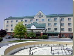 I got a late start from the house, because I hadn’t completely packed the bike earlier in the week, programmed the two GPS receivers, and so on. Riding north on I-270 on the Friday of Memorial Day Weekend isn’t the brightest thing to do, and it got worse as the day wore on. That was the first rookie mistake of the trip, because it pushed the schedule to the right so I had to quickly (a) check into the hotel, (b) get gift cards at TARGET to be used as a donation, (c) get the required six-pack of a beverage of choice, (d) check into the rally with (b) and (c) in hand, and (e) run the odometer check (15.n miles, where n = 3, 6, or whatever, depending upon the bike / tires / …). All that, and don’t be late to dinner at 1800!
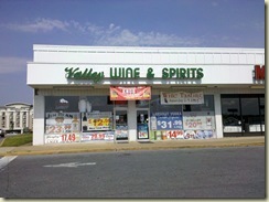 Valley Wine & Spirits is the closest adult beverage dispenser to the Rally HQ hotel, so it was on the mandatory stop list.
Friday’s dinner was awesome. We had catered Mexican food – a build-your-own taco salad, with chicken and beef. Needless to say, there was good Mexican beer to go with the chow.
A mandatory first-time rider’s meeting started at 2000 and ran until about 2130. I was beat, so I set myself up for the second rookie mistake of the trip by not making sure my fuel tank was topped off before Saturday’s departure. More on that, later.
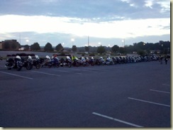 We arrived at the 0500 rider's meeting with our helmets; we had already staged our motorcycles on a very long line (~70 motorcycles) in the parking lot behind the hotel. Why did we need helmets at a rider's meeting, you
 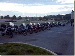 ask? Rick had a treat for us: a Le Mans start. We lined our helmets up along another line in front of our bikes, and we lined up even further forward. On command, everyone walked briskly (ran?) to their helmets, then on to their bikes. Engines roared (okay, these bikes don't "roar"; many sound more like sewing machines) to life, and individual riders found their way to their selected route.
Many of the riders heading south to Arlington County, VA took the same route out of the parking lot. Individual riding styles caused the pack to thin out quickly, as each rider hit his or her stride. The weather was perfect -- the roads had dried out from the thunderstorms that had swept through the area on Friday evening (right around our dinnertime). The temperature was very pleasant, matching well with the light clothes I was wearing under my riding gear. I expected the temperatures to rise as the day went on, and planned to be uncomfortably hot by the afternoon.
I stopped for fuel about halfway to Arlington -- one of several unforced errors during the rally. As I mentioned earlier, I started for Hagerstown late on Friday, and wound up in a typical I-270 freeway parking lot. It took about an hour more to get to Hagerstown than it should have. That delay made getting fuel before the odometer check problematic, and I didn't get fuel after the mandatory first-time Mason Dixon 20-20 rider's meeting (which ended about 2130) because I was beat and there isn’t a fuel station anywhere close (that I could find). So, I took that extra fuel stop and chewed up a lot of time (ten minutes or more!) getting through neighborhoods and traffic lights on the way to the station. Fueled up, I continued south on I-270. Traffic was flowing very well and visibility was great: all-in-all a great ride.
My route took me south on I-270 to I-495, then to the Clara Barton Parkway. Even with living in northern Virginia for more than 20 years, I haven't spent much time on that road. I continued south to the turn onto Key Bridge, and made another unforced error (and one that I have made before, in a cage!). I turned onto the Whitehurst Freeway, instead of waiting another block to turn on U.S. 29S (the Key Bridge) to Rosslyn. That error ensured that I spent probably 10 minutes goofing off in DC on the way to I-66. I got through picturesque downtown Rosslyn okay, and made it to the U.S. Marine Corps War Memorial, where there were a number of other riders getting their photographs. I knew the photograph that I wanted, and walked briskly to the memorial to set it up. I knew I had to have three things in the frame: the memorial, the Washington Monument, and my rally flag.
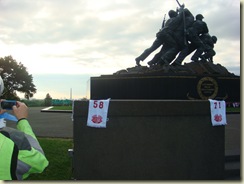 From personal experience, I knew there was another critical stop to make at the U.S. Marine Corps War Memorial: the portable facilities between the memorial and the Netherlands Carillon. Feeling much better after that stop, it was time to head east on VA 110 to pick up I-395 northbound. That transition was trouble-free, and off I went to pick up DC 295 / MD 295 on the way to I-895. It was interesting to ride the Baltimore Washington Parkway, since that’s my usual route to and from work – the traffic was certainly different on Saturday than it is during the week.
On my way to I-895, I was nervous about getting the EZPass to work correctly; I keep the "puck" in a clear pocket on my left sleeve. Previously, I had hit-or-miss performance with the puck in my pocket. I experimented a while with placement, taking to waving the puck at the first few toll booths as I rode north.
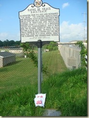 Clearing the I-895 tool booth, I was off through the tunnel, heading north to Havre de Grace, MD. Riders that finished higher than me in the final standings skipped these MD and NJ bonii, so it was definitely a tradeoff between getting some points early and getting through Manhattan before the day wore on. It was nice to get off the bike for a few minutes to get the photo, though. I learned that the medium binder clips just aren't good enough -- the large size are needed to clip anything on to the usual roadside historical marker (later, I learned another invaluable trick: clip the flag to a clipboard, and lay the clipboard up against whatever needs to be photographed). I put my flag on the tall grass in front of the sign, and got the needed shot.
I took a wrong turn out of that location, another rookie mistake, which cost me a few more minutes as I headed back to the highway. Crossing the bridge into Delaware, I picked up I-95 north again (and more toll stops).
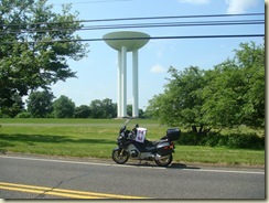 I picked up the NJ Turnpike just off the Delaware Memorial Bridge. I usually take I-295 (from my days of traveling to and from Moorestown, NJ), but figured that my best time could be had on the turnpike. I left the turnpike to travel to Holmdel, NJ to get a photograph of a transistor-shaped water tower. From there, I headed north on the Garden State Parkway to get to Staten Island.
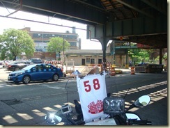 Crossing Staten Island, led me to the New Utrecht Avenue Station on the BMT Sea Beach Line and BMT West End Line in the Bensonhurst neighborhood in Brooklyn. This station is where the chase in The French Connection ends, so it wound up on our bonii list. I had to find the correct entrance amid all the usual construction, then park the bike to get the shot. There was another rider there at the same time, so we exchanged a few words as we got our photographs. He was checking the oil level in his Kawasaki as I was getting ready to leave, so I made sure he was good to go. Leaving Bensonhurst, he went one way, and I went another, but we both wound up in a big accident scene. He scooted between two cars and made a right turn; I followed closely behind. We rode around the wreck successfully, and entered the Brooklyn-Battery Tunnel to get to Manhattan.
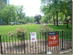 I got to Battery Park just fine, and pulled up in a bus loading zone; I knew I wasn’t going to be there long, and jumped off the bike to get the required photograph. The object in the background is a sculpture that had been at the World Trade Center; it was severely damaged in the collapse of the two towers, and is now on display in Battery Park.
Another thing I didn’t plan well enough was my route from Battery Park to the Holland Tunnel. Traffic was bad and getting worse, and GPS reception in lower Manhattan is always bad. I bumbled my way north on the island, though, and managed to get on 12th Avenue. The traffic getting into and through the Holland Tunnel was miserable, and the tunnel was pretty warm. My oil-cooled bike thought it was pretty warm while idling in the tunnel, as well…I kept one eye on the traffic and the other on the temperature gauge. It was good to see the light at the end of the tunnel, even if it was New Jersey(!).
By now, I’m about an hour behind where I should have been to make the back end of the trip manageable, so I’m busy thinking about shedding some bonii as I ride along.
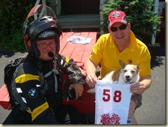 Leaving New York in the rearview mirror, I was off to Easton, PA to have my picture taken with Jim Owen and to purchase a food item from Fat Daddy’s Southern Bar-B-Q. I was happy to get off the bike for a few minutes, but managed to spend a lot more time there than I should have. Instead of getting something to throw in the tank bag so I could continue to roll west (another rookie mistake, motivated by saddle-induced soreness), I got a little potato salad and a little cole slaw, and ate them in the parking lot while giving my sitting apparatus a little rest from the saddle. It was nice to chat a bit with Jim; he was with us on Friday evening and at the scoring table and dinner on Sunday.
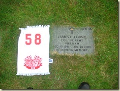 From Easton, I rode to the Indiantown Gap National Cemetery to visit Jim Young’s gravesite. Jim died near Paradox, CO during the Thin Air TT rally in July, 2001.
The cemetery is beautiful; I’m looking forward to returning to visit when I have a little more time.
It started to rain a bit as I was pulling out of the cemetery, and I needed fuel. I also needed to get another of the wildcard bonii: a $2 scratcher lottery ticket (had to be from MD, PA, or WV). There’s a gas station just down the road from the cemetery, so that was the logical place to stop to get both jobs done.
The rain doesn’t look like it’s going to be a major problem.
Major decision point. I’m far enough off my plan now, that I need to make some quick decisions. The fellow who was with me at Fat Daddy’s was on to Reading, PA – I’d decided against Reading early in the planning process because I didn’t think it offered enough points for the time and distance required. I had planned to pick up three locations to the north, up U.S. 22. With time problems, I decided to shed the U.S. 22 locations and head west. That turned out to be a good decision for at least two reasons – U.S. 22 was far more likely to be critter-ridden that the Interstate (the VAST number of road-kill on the PA Interstates is a caution flag) and I was to be riding on U.S. 22 during “critter time”, and it turns out that the extra time on U.S. 22 would have really cramped my ability to finish before the deadline. What I didn’t do, though, as part of the replanning effort, was to realize that I should have picked up the Flight 93 site on Saturday (since I rode right past it while heading to Indianapolis) – yet another rookie mistake. I had half of the re-planning effort thought out in advance, but didn’t work all the details. That mistake cost me points at the scoring table.
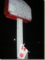 So, mistakes aside (and a longer meal stop than I should have taken at a rest area on the PA Turnpike), I’m on to the John & Annie Glenn Historic Site in New Concord, OH to take a photograph of their sign. Two other bonus seekers ride up as I’m finishing my little photo op. You can just make out the reflective material on their riding clothes in this shot.
Now, as you can tell, it’s pretty dark. I’m okay for a few more hours of riding, but the skies are threatening. I work the numbers in my head as I ride, and elect to stop in Springfield, OH just as the skies are really looking bad. As it happens, another rider was caught in that storm and wound up with a tank-slapper, going down in the freeway. I understand he was banged up a bit, but otherwise okay.
I snagged a room at a hotel right around midnight and bagged just under three hours of sleep. I woke up fine, and headed downstairs to check out, only to find the lobby area locked. Ugh. I walked around to the front door to see what the issue was – as soon as I left the hotel to make the turn to the front door, I was confronted with the gas station across the street being completely full of cars and people. No one was getting gas (at this, the only gas station open as far as I could see) – they were all at the gas station to party at 0300!
After staring at this spectacle for a few minutes, the guy at the front desk let me in. He wasn’t quick enough in locking the door behind me, and some party-goers came in to use the facilities (which concerned the night manager greatly). I was anxious to get out of there as quickly as possible, so didn’t spend too much time chit-chatting. My rest bonus had started at the party-goer-ridden gas station across the street, and I needed fuel for the next leg, so I shoe-horned my bike between a car and the pump and managed to get a tank-full. In my amazement at the crowd,I managed to miss getting the required photograph of the pump to satisfy the fuel log requirement, costing me 5 points at the scoring table. Five points at this rally was huge. Oh, well…another rookie mistake.
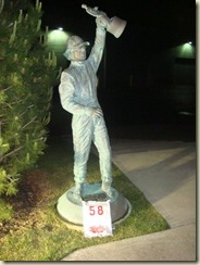 I’ve got a long, long slog now to Indianapolis, where I’m to take a picture of a driver’s statue in Brownsburg, IN. There was another rider there at the same time I was…always nice to have a little company at a bonus stop.
From there, I had to get to Speedway, IN to grab another photo. As it would turn out, the approach from Brownsburg was probably the only reasonable way to get into Speedway, since the cars were already lined up for miles to the east to get into infield parking. What a zoo! Anyway, I get to the appointed location, jump off the bike (there’s another rider there, as well, looking for the right thing to take a picture of), and start hunting. The RM had sent a text that I didn’t get until MUCH too late, telling us that the description of the location changed from museum (which is really in the infield) to administration building (which is where I was). So, I spent a half-hour trying to finagle my way onto the infield (to no avail), then had to bail to get back to the Flight 93 memorial and on to Hagerstown before the deadline. Yet another rookie mistake.
So, I’m on my way back east, having experienced Indianapolis on race day (which is awesome), and I’m riding into the rising sun. What a beautiful sight! I’m a bit hungry, so I stop (again, for longer than I should have) for a bite at a rest stop.
After riding all morning, I arrived at the Flight 93 National Memorial, where I snapped this picture.
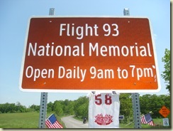 Two well-laden touring bikes passed me on their way in, slowing down to make sure I was okay. What a nice riding community, these long-distance touring folks are. At first glance, I thought they might be on the rally, but then noticed they had dry bags, so were out camping as they rode along.
By this time, I’m running against the clock, knowing that I’m going to lose more points at the scoring table because I’m going to bust the 1400 end time. Upon rounding the corner to the finish line, I stopped and hopped off the bike long enough to put my sponsor decal and rally flag on my bike (both were bonus points – the decal was pre-announced, and the rally flag (because it had a checkered flag on it) was a wild-card bonus).
I ended up coming in 14 minutes late (for a 14(!) point penalty). Again, oh well.
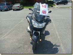 Here’s my bike as it looked when I crossed the finish line, rally flag and all.
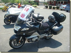
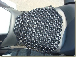 So, for about 1598 miles over 29.5 hours in the saddle, I sat here…
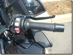 and twisted that.
Epilogue. I was, characteristically, the last bike out of the hotel’s parking lot on Monday, taking advantage of the standard noon checkout. I’d taken advantage of a slow morning to indulge in my other scavenger hunt hobby, geocaching, in the area around the mall. While hiking around, I came upon the site of the Saturday evening skills tests, with the target times chalked onto the pavement.
With the rally over, I was left with the decision about the route home. Rick had announced, the night before, that the theme of the 2012 Mason Dixon 20-20 would be Mountain Do Do (sp?). That inspired me to ride west to Cumberland (where I tested my bike’s ability to find a Dairy Queen for a celebratory Blizzard™). 
After dessert, I rode south to Moorefield to let the RT off the leash in the sweepers and twisties so common in West Virginia. Just north of Moorefield, I headed east on the infamous Corridor H (the freeway from nowhere – Virginia hasn’t lobbied / won’t lobby to get it connected to I-81 in the vicinity of Strasburg to, largely, nowhere. Senator Byrd died just a few miles too soon to fully realize this tourism boon, though I’m sure that the easternmost counties do benefit from the old guy’s fondness of spending other people’s money. The old WV 55 is still there, and is a great ride. I was still a bit sore from the ride to and from Indianapolis, though, so I took the more direct route when it was available (see, maybe the old unreconstructed southern Democrat was on to something…). I continued on VA 55 after crossing the state line, all the way to just shy of The Plains, where I picked up I-66 eastbound. Ahhh, the slab again. Traffic was remarkably light, so the rest of the trip back to Fairfax County was uneventful (but very hot and humid – the thermometer on the bike registered north of 95 deg F as I was rolling east on I-66).
Unforced errors. Made far, far too many. Practice will help with some of this. A more comfortable saddle will help, as well.
Bottom line: great experience, tremendous fun, very safe (no situations at all -- nothing hit me, and I didn't hit anything (though I did have a close call with something that looked like a small rat or large mouse that tried to charge across a road in front of my bike after I left the Flight 93 National Memorial)), somewhat sore (the IBA doesn't call it a "bunburner" for nothing), lots of good experience and many lessons-learned.
What didn't work well. Getting fuel early spent critical time early in the run. Wrong turn onto the Whitehurst Freeway -- spent at least five minutes goofing off in DC on my way to the memorial. Bad turn out of Havre de Grace.
What worked reasonably well:
- Planning – I had a decent plan that, if I’d ridden it, would have turned out pretty good. Major problem: not leaving enough time in the plan for fuel and bonus stops.
- Routing – decent routing. I came up with a way of figuring out how much of any given route is taken up with specific types of roads, which is a useful thing to know. Also, I learned how to compare the results of MapSource routing and the routing computed by my GPS receiver. MapSource allows you to tinker with the speeds for different classes of roads – the GPS receiver uses whatever the posted speed limit is to compute the route. These are wildly different results, and it’s useful to understand why.
- Options – bailout. Work them out in advance, write them down, and put them on the tank bag. Worked great for me, except I hadn’t thought through the implications of one of my bailout plans.
Additional points of enjoyment:
- Environment – this is a beautiful country. It’s even more beautiful on the back of a nice bike.
- Weather – weather was really good for me. There were a few spots of rain, heavy at times, but never to the soaking point or to a point where I felt unsafe. Following my intuition in Springfield, OH saved me a drenching (or worse). The area I rode through had really nasty weather just a few days before (lots of tornado warnings / watches), but things were generally pleasant for the ride.
- Great gear – great helmet, great riding clothes, great boots. Made for a comfortable ride (aside from the stock saddle discomfort).
- Food and water – brought the right amount and type of food in Chez Tankbag, and bought a 3 liter water bladder that I wore as a backpack, which worked great. A bit tight to get the bite valve up under the chin protector on the helmet, but doable.
Other things I learned:
- Pennsylvania ought to change from the “Keystone State” to the “Road-Kill State”. Seriously. I don’t know where all the buzzards are; there’s enough road-kill on the Interstate highways of PA to do a remake of Hitchcock’s The Birds.
- Endurance rallying is truly a mix of skills – route planning, efficient and safe riding, reading comprehension, …
- I have too much patience for some things.
- Re-read the IBA list-of-things-to-bring. I brought everything I needed, without bringing too much stuff I didn’t.
- Practice. Practice making bonus stops. Practice making fuel stops. Figure out what the average time is, and factor that into the plan.
- Packing. Keep things exactly where they belong all the time. The wallet goes in a pocket. Two sets of keys. Spare cash for when the credit card stops working. Camera in the same location each time. Rally flag in the same location each time. And so on….
- The Droid doesn’t like being hooked up to the bike in the tank bag on hot days. It doesn’t like being out in its carrier, either, because of overheating. No real, practical solution to this problem. Using the Droid as a cheap substitute for a Spot doesn’t work for me.
Bottom line. Great rally, put on by great people, ridden by great riders. Awesome experience – can’t wait until next year.
I’m inspired to run The Void in October, Cape Fear next April, the MD20-20 next May, and the Butt Lite next summer.
