It was ages ago that I signed up to ride Butt Lite 6IX. I’ve ridden several “single day” (i.e., fewer than 36 hours) rallies – Mason Dixon 20/20 in 2011, The Void in 2011, and Cape Fear in 2012. I had a lot of fun in those rallies – planning the ride, and riding the plan. After the 2011 Void, I thought I’d be ready to run my first multi-day, so in went my application for Butt Lite 6IX.
Lisa Erbes has a nice discussion of her decision to continue the Butt Lite tradition – it’s worth reading to get the context on this event. In short, the goal was to have 66 bikes (single riders or two-up couples) put in 6000 miles over 6 days. Lisa recruited three very experienced Rally Masters and a slew of great volunteers to put on a first-class rally. In the end, 58 bikes started, and 52 successfully completed.
Jumping to the “bottom line, up front”, here’s my track as it was recorded on Spotwalla (based on my Spot track):

Note that there’s a gap in the track in Minnesota…as it turns out, Spot turns the tracking feature off if it’s been on for 24 hours. I know that, now, so there aren’t any other gaps in Spot coverage.
Now, on to the story.
Preparation.
I enlisted Connie to participate in several practice rides – we did a VERY hot weather ride out to Western Maryland, and another to Buffalo, NY. Both rides were very good at wringing out gear issues. I’d had a 36,000 mile check done on the bike by the service department at Bob’s BMW right before the Buffalo trip, so part of that trip was scuffing up the tires and making sure everything was squared away before heading off for what I thought might be an 8,000 mile trip.
I used the Iron Butt Association pre-ride checklist to make sure I had what I needed for the ride. As it turns out, I packed too much of some stuff, but just the right amount of other stuff. I’ll cut back a lot on some things next time.
The ride to Blairsville.

I departed Northern Virginia MUCH later than planned – I had the usual issue of getting home from work (the Preliminary Design Review ran long), and still had a little packing to get done before shoving off. I wound up getting out of the driveway around 2300. I had planned to ride west on I-66, then south on I-81 to avoid the inevitable fiascos on I-95. My route turned out great – I overnighted in Woodstock, VA, then got up and got going in the morning with sufficient margin to arrive in Blairsville, GA before the 1700 tech inspection cutoff.
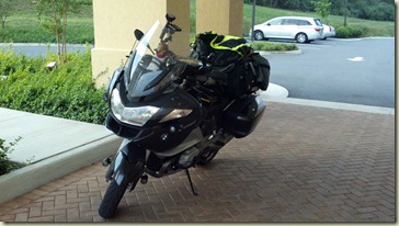
This is what a clean bike looks like (before the windscreen becomes bug-encrusted) – this shot was taken at the hotel in Woodstock, VA:
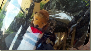
Connie loaned me this little otter to use as a mascot for the trip – he was bundled up in a sock, and tie-wrapped to the primary GPS mount for the entire trip. This is what he looked like in Woodstock, VA.
The ride down I-81 was really nice – visibility was very good, and traffic was manageable. I had wanted to stop off to do a little sightseeing (and geocaching) on the way down, but the late departure from the house the night before cut into the time I’d have for flower-sniffing. That’s a general rally fact – a minute spent doing something now takes a minute away from doing something else later on. While that’s true in life generally, that condition is particularly noticeable on “rally time” since everything is “on the clock”.
I made it to the rally start at the Lodge at Copperhead in Blairsville, Georgia with plenty of time to spare. I got checked in, got the bike inspected, and learned that the odometer check was a bit longer than I wanted to ride (~133 miles?).
This is the view from the cabin I was assigned:

The lodge is in the background of this shot:
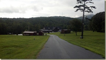
The pool adjacent to the lodge:

We had a rider’s meeting in the early afternoon, and a nice meal before the Leg 1 rally packs were issued immediately after dinner.

Leg 1: Blairsville, GA to New Ulm, MN.
The rally pack consisted of several items:
- List of bonus locations (bonii),
- Scoring booklet,
- Rally flag (precious cargo, not to be lost or misplaced!“,
- “Thumb drive” – containing three files that described the physical locations (latitude and longitude) of each bonus location, and
- An express mail envelope that needed to be turned in at scoring.
Each rider retired to his / her room, and started to plan their ride (note that while we’re not “on the clock”, all Leg 1 planning is done at the expense of sleep). There were no “mandatory” bonii on Leg 1, but Eddie James’ grave in Atlanta offered big points, and there was a huge point bonus at the Waffle House museum to snag a “special, mystery guest” signature on our souvenir Butt Lite 6IX coffee mugs (which are great swag). So, my route started with a trip south to Atlanta.


The riders and staff met for breakfast, which was excellent. The Lodge at Copperhead puts on a great spread. A short rider’s meeting revealed no major changes in the Leg 1 bonii, so I was good to go.

More pre-ride photos are here.
We started at 0800, and riders began to spread out along the route south.
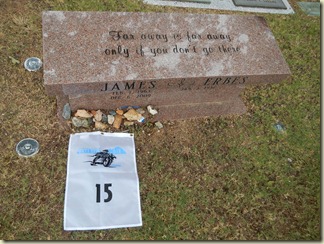
My first stop was Eddie James’ grave in Atlanta (for 400 points). My geocaching experiences ought to be enough to tell be to be leery of cemeteries and parks, because you can really get goofed up on routing. Sure enough, the GPS route to Eddie James’ grave put me right on a closed goat trail. Some riders figured out the painless way in, the rest of us spent 15 minutes or so hiking into (and then back out of) the cemetery.
There were two bonii after the cemetery – there was a third on my original route, but I thought that would offer little in the way of points, while offering a lot in the way of delay, so that bonus was dropped enroute.
Site of the surrender of Atlanta, GA (21 points):
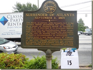
I’ve since learned that this is a very busy intersection in Atlanta, but didn’t notice that the traffic was all that bad when I was there.
Sideways was a dog that had been adopted by students at Georgia Tech – this is his grave marker (and some other rider’s arm – John Frick?). This photograph was worth 42 points.

And now, on to the Waffle House Museum in Decatur, GA, on the site of the first Waffle House.


We had been issued official Butt Lite 6IX coffee mugs that we were to have signed at one or more locations along the route (for BIG points). This was my first signature (worth 1000 points). The photo wasn’t required, but I wanted to have the picture for the record. Note the fancy “chip clips”.

Next stop: Rose Hill Cemetery (wow!, were the roads narrow and twisty in the cemetery – great slow-speed riding), to visit at pay respects at the graves of Duane Allman and Berry Oakley:

The cemetery photograph was worth 150 points.
Next, I was off to the scene of Duane Allman’s fatal crash at the corner of Hillcrest Avenue and Bartlett Street in Macon. This photograph was worth 150 points.
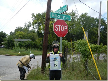
And then, I rode just a few blocks away to visit the scene of Berry Oakley’s crash, that occurred about one year later. Berry Oakley’s crash proved fatal later that day, after he went home instead of seeking medical treatment (contemporaneous accounts said he would have succumbed to the skull fracture, regardless of any medical treatment he might have received). This photograph was also worth 150 points.

I realized, as I was in Macon, that I didn’t compute an optimal route through Macon, which probably cost some time.
Then, I was off to visit the grave of William Samuel McTier AKA Blind Willie McTell for 66 points:

I had to get a receipt from anyplace in Statesboro, GA (there’s no picture for that part of the adventure) for 99 points.
These last two bonii were part of a combination, so there were additional points available for doing both.
There’s a find piece of roadside art near Savannah, Georgia, worth 134 points:

This sign, commemorating the composer of the perennial Christmas favorite, Jingle Bells, was worth 41 points.

This photograph, inside a bar on Tybee Island, Georgia, was worth 123 points.

By this time in the day, I’m hungry and tired, and I know I have a lot of riding left. One of the things that separates me from the true “big dogs” is my inclination to stop periodically to have something “real” to eat, and to rest a bit. I stopped at Wendy’s (I figured someone would approve!) to recharge a bit. From that stop, I continued west.
This photograph, in Enigma, Georgia, was worth 101 points.

While you can’t see it very well, this is a photograph of a kinetic statue of Ray Charles in Albany, Georgia, was worth 114 points. I had two auxiliary (portable) lights with me – one battery-powered, and one powered by the bike. I used the battery-powered one to make this [feeble] shot.

For some reason, I managed to get myself routed off of the freeway leaving Albany enroute Montgomery, Alabama. The road was just fine, but I suspect I would have made better time on the freeway.
I overnighted around Union Springs, Georgia, at some little mom-and-pop, no-frills motel.
I got rolling early, and headed west. My first bonus location of the day was to this site south of Vicksburg, Mississippi. The best (and only) twisties of the whole trip were on the road to and from this location. The photograph was worth 401 points.
The cars in this photograph belong to some kind of sports-car club – they were staging up in Port Gibson, Mississippi, as I rode through to the site. As soon as I parked for the photograph, all of these folks showed up. I got my picture, then threaded my way through the cars to get out of town and back north. I was in a rush to get out of this crowd, so I waited until I got back to the little town to stop for a bite to eat out of my tank bag.

This photograph of a bat on a water tower in Transylvania, Louisiana, was worth 143 points.

This sign in Greenville, Mississippi celebrates the first legal liquor store to open in Mississippi post-prohibition. Jigger & Jug, which opened on 6 August 1966, is still open for business after all these years. The photograph was worth 111 points.

My stomach got the better of me (for the day), so I stopped to refresh at McDonalds in Clarksdale, MS – another big use of time, but it sure seemed like a good idea at the time.
My next stop was to find a sign noting the home of Levon Helm at the entrance to Marvell, Arkansas (202 points). The location given in the rally book was for a place near the center of town – NOT at the location of the sign. This is pretty typical of rally books that I’ve seen – making reading comprehension essential if you’re going to figure out where the sign might be located.
There are three primary routes into Marvell – my route caused me to use one of those primary routes. As it turned out, the route I used didn’t have a Levon Helm sign. I spent a little time going back to the edge of town to verify that I didn’t pass by it by mistake, then headed further down that road to see if I could find the right sign. And, here it is:

The next stop was the William Jefferson Clinton Presidential Library in Little Rock, Arkansas, to pick up 383 points. I didn’t have the scale set right on my primary GPS, so it took me longer than it should have to locate this gigantic building.
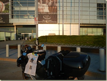 From Little Rock, I headed north to Missouri.
This monument in Harrison, Arkansas commemorates the Mountain Meadows Massacre – the photograph was worth 666 points.

I got some sleep at the Day’s Inn in Mountain Grove, Missouri, then hit the road. I had intended to overnight in the Cape Girardeau area, but stopped a little short.
After a nice rest, my next stop, the Rush Hudson Limbaugh, Sr., United States Court House in Cape Girardeau, Missouri, was good for 112 points.


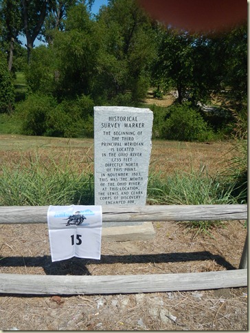
A Third Principal Meridian marker near Cairo, Illinois was worth 300 points. I couldn’t know it at the time, but I would be back through here searching for yet another Third Principal Meridian marker in just a few days.
Cairo and the surrounding area is very interesting, and very historic – a lot has happened over the past few hundred years along the Ohio and Mississippi rivers.

There’s a statue of intrepid newspaper reporter Lois Lane in Metropolis, Illinois. This photo was worth a whopping 777 points.
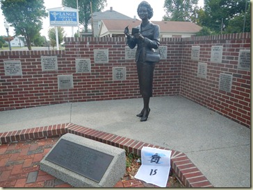
This plaque in Makanda, Illinois reads:
In memory of
Boomer
The hound dog that tradition says
dashed his life out against the abutment
of the iron railroad bridge 300 feet
south of this spot while running on
3 legs, trying to put out a flaming
hot box on the speeding train of his
beloved fireman-master.
Sept. 2, 1859
The photograph was worth 333 points.

The ride out of Makanda took me through some very nice park land.
My McDonalds stop of the day was in Benton, IL – another huge use of time, but it felt good to get off the bike for a few minutes, and to get some ice in my hydration bag.
Following the stop in Benton, I had a ride north on I-57 to Arcola, Illinois, to visit the site of the National Hippie Memorial, for a photograph worth 420 points (a little Rally Master humor there – very little).

Rolling into Arcola, I spied this restaurant, so stopped (briefly) for a picture on my way back to the slab. Note that there we no chickens (live or otherwise) in sight:

I had another long ride north, to the shore of Lake Michigan. I needed to get fuel before the next bonus, and wound up getting involved in a long conversation with another of the customers. Wrapping up the conversation, I was off to take this photograph of a “futuristic” home that was worth 141 points.

In hindsight, I think I made a mistake to drop three small bonii enroute to Chicago. These three bonii (total of 144 points) were very close to one another, and it would have been trivial to make two stops to get the three bonii. Oh, well.
Another interesting feature of this rally was having bonii with identical locations – this made routing using MapSource a little challenging.
I dropped a 62 point bonus on the way to Chicago – I probably should have rethought this, as well. While these were low value, the marginal cost to pick them up was also low.
I had also dropped this next bonus, because the point value was pretty low (72). I rode right by it, though, so I went back quickly to get it. It marks the boundary between Illinois and Indiana.

This sign, painted on a exterior wall of a shed at Calumet Fisheries, was worth 182 points.

Then, I was off to visit Pilgrim Baptist Church for 203 points. Pilgrim Baptist Church served as Triple Rock Baptist Church in the film Blues Brothers.

I really like rallying in cities, and had a lot of fun doing the bonii in and around Chicago. Well, except this one. There’s a McDonalds restaurant up on this elevated freeway. The trick was to ride up the ramp, park at the McDonalds, get a receipt, then go back through the toll booth to continue west. I interpreted the rally book’s “if you can’t get a receipt, take a photo” comment to allow a photo – this was disallowed at the scoring table (because I could have gotten the receipt if I had been willing to wait about 10 minutes). Ugh. That cost 170 points.

Then, I was off to the Palace Hotel. I blew this bonus on reading comprehension – the actual bonus was INSIDE this building (see where the pickup truck is exiting the building). This mistake cost me 107 points.

Once I’d had enough fun in East Chicago, it was time to head into town to remind myself how poor GPS coverage is in a city with tall buildings. I hadn’t taken the time to refresh my memory of the Chicago street layout, so I had to do that work on the fly, relying on the street addresses of the bonii.
It was raining lightly as I arrived downtown. Fortunately, the traffic was light and there weren’t a lot of pedestrians jay-walking. I went around the block several times as I hunted the two bonii downtown.
This is some artwork in Daley Plaza in Chicago – the photograph was worth 136 points. Daley Plaza was also featured in the Blues Brothers.

This is a photograph of a giant bat (worth 137 points)…I couldn’t get the entire bat in the shot, it was so tall.
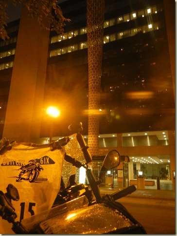
Continuing the Blues Brothers theme, we were to ride to 1060 W. Addison Street, Chicago, IL to visit the address that Jake Blues used on his Illinois Driver’s License. This photo of Wrigley Field was worth 350 points.

And so, naturally, I had this quote rattling through my brain as I’m heading out of town:
Elwood: It's 106 miles to Chicago, we got a full tank of gas, half a pack of cigarettes, it's dark... and we're wearing sunglasses.
Jake: Hit it.
One more stop – Oak Park, Illinois, to get this photograph (133 points):

I skipped a 92 point bonus in Evanston, Illinois.
Leaving Oak Park, I was really hungry, so I stopped off for a hot dog at Gene & Jude’s in River Grove, Illinois.
From River Grove, I had a really long slog on the slab all the way to New Ulm, Minnesota.
I showed up at the checkpoint at 0540 (beating the 0600 – 0800 penalty window). I worked on my score sheet for a few minutes, then got into the scoring line. The rally staff and volunteers kept the scoring process fast and efficient. There was a hot breakfast, as well, which was really nice.
Leg 2: New Ulm, Minnesota to Denver, Colorado.
At about 0800, the Leg 2 rally pack was passed out, and we were off again to plan the second leg of the rally. I sat down with my computer and laid out what I thought was a fun and interesting ride. While I’d been very careful to select a Leg 1 route that would maximize points and minimize time in the saddle, I was tired enough during second leg planning that I went for big points north and east of Minneapolis that I just couldn’t reach. The story of my second leg was shot through with overreaching, which required a lot of on-the-fly replanning, Iron Butt Motel resting, and what seemed like a zillion miles of slab with few bonii until I reached Detroit. But I’m getting ahead of the story.
I left the checkpoint, and headed about an hour and a half away, in Minneapolis, Minnesota, for what was a mandatory stop in disguise – Bob’s Java – to get my coffee mug signed again (1874 points) and to get a receipt (125 points).
The route I’d selected out of New Ulm had me heading north (instead of west), north to the Upper Peninsula.
This stop was the most gravel and sand of the entire rally. The photograph was worth a modest 85 points.

The, I was off to Duluth, for 99 points. I’m glad that I went to Duluth to see the place, but this was not a good route (or stop) for the purposes of rally bonus point collecting.

As a simple measure of what a bad route this was, I only had four bonus stops for the whole day, and two of those were in the same location in Minneapolis!
I overnighted at the Comfort Inn in Ironwood, Michigan. I was far enough behind my unbelievably ambitious plan, that I dropped two really big point bonii that I just couldn’t get to.
This photograph was worth 399 points.

This lighthouse photograph was worth 600 points.
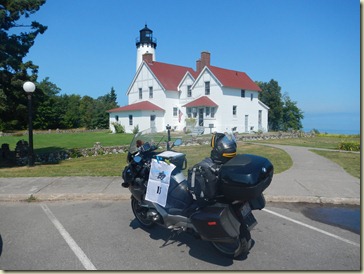
My McDonalds stop of the day was at St. Ignace, Michigan – yet another huge time sink. I got my meal, and proceeded to eat it outside – the weather was beautiful.
Next, I got a chance to ride across the famed Mackinac Bridge. Bridge construction had the two outer lanes (the ones with pavement) closed, leaving the two lanes with metal grates (ugh) open to travel.
My next stop was Tawas City, Michigan, on the shores of Lake Huron. There’s a spot with a LOT of cartoon characters out in the yard – we were to take a picture of Pooh (who’s looking a bit shopworn these days). Pooh was worth 686 points.

I was back in full rally mode…all the fatigue of the slab slipped away as I hunted the elusive bonii in the Detroit area.
My next stop was a place known as the Hamtramck Disneyland. In a rookie move, I didn’t read the bonus description completely, and missed the fact that I was to take the picture FROM THE ALLEY. I couldn’t imagine that there would be a 24 hour bonus in an alley in a residential neighborhood in Hamtramck, Michigan, but there it was. I took my picture, and lost the 650 points somewhere on the scoring table. Oh, well.

Next stop – the home of the “Motown Sound”, for a photograph worth 400 points. Venturing just a few blocks off the main drag got me into some really interesting alleyways.

I next needed to get a receipt from the Obama gas station in Detroit, to earn another 666 points. It was a very interesting neighborhood. I bought a bag of chips, got my receipt, then went outside to take a few pictures. The station attendant remarked that all the “bikers” wanted receipts today. Imagine that.
Just couldn’t avoid the phrase “drill baby, drill” from popping into my mind as I rode away.

Having visited the Obama Shrine gas station, I headed off to another cemetery, to visit the grave of the father of the blues, Eddie James Son House, Jr.

The last stop in Michigan was to visit this plaque that celebrated Rose 2d of Aberlone in the very pleasant town of Plymouth, Michigan. The photograph was worth 300 points.

Getting out of Plymouth was a real chore. My primary and secondary GPS receivers couldn’t agree on a route south to Paducah, Kentucky. I was also getting cold, and needed to get my jacket liner on. In the process of pulling out the jacket liner, and getting it put on, I managed to drop (and subsequently step on) my glasses. Ugh. To celebrate the routing challenge and the smashed glasses, I did a few miles on a gravel road to get back to a main thoroughfare. All-in-all, I managed to waste entirely too much time getting out of town.
I needed to get south, and was running out of day (and steam), so I overnighted at the Comfort Inn in Lima, Ohio. Once nicely rested, I continued on to Kentucky.
This statuary is located on the grounds of the National Quilt Museum in Paducah, Kentucky – the photograph was worth 302 points.

And, here’s my second stop at a Third Principal Meridian marker near Cairo, Illinois. The photograph was worth 303 points.
This 225 point photograph was taken near Cairo, Illinois.
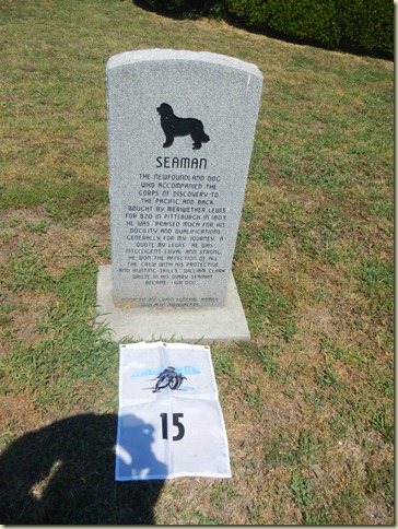
The fatigue I experienced when I planned the second leg caused me to ride right by an easy (and large – 341 points) bonus in St. Louis. That bonus was on my list of bonii on the top of my tank bag, but that list was obscured by the holder for the rally book. When I entered the Leg 2 bonii in the primary GPS, I neglected to enter that particular location. Additionally, the next stop was time-limited (I needed to have the photograph taken before 1700 to beat the gate closure time) – I made it with 10 minutes to spare.
This monument to William Clark (at his grave) was worth 120 points.

I made another routing mistake in St. Charles, Missouri. I got this low-point photograph (90 points), but didn’t get the high-point location (362 points) into the route. The high-point location would have taken another 10 minutes (maximum) to get, so this was a really big mistake.

I dropped the 265 point bonus in Jefferson City, Missouri, because I needed to get down the road to Kansas City, then on to Denver. I knew that I had enough time budgeted for the Kansas City stops, and for some sleep enroute Denver, so didn’t have any extra time to spare. I dropped a 136-point bonus in Independence, Missouri, that I probably should have stopped for because the marginal cost would have been low.
In Kansas City, there were two bonii right on top of one another. In yet another routing error, I didn’t realize this, and left the first bonus (the 301 point photograph, below), only to ride around downtown a bit to find the second. I got back to the same location, wrote down the answer to the question (which was worth an additional 60 points), then headed west.

Then came the very long slog west on I-70 across Kansas and eastern Colorado. Ugh.
My penultimate stop was the final mug-signing bonus location – at the Littleton Cemetery in Littleton, Colorado. This final signing was worth 888 points, and had to be claimed between 0900 and 1100.
The deadline for riding across the finish line at the Marriott Hotel at Denver Tech Center was 1100. I left some schedule margin for traffic to Littleton and along the route between Littleton and Denver, so I was able to get to the finish line with plenty of time to spare.
Here I am, approaching the finish line – the end of the riding portion of Butt Lite 6IX (and nearly the start of the second trip to the scoring table):

And here I am, waiting in line to have the odometer read.

Next stop – the scoring table.
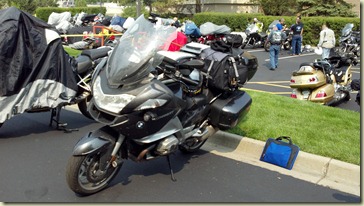
The scoring table.
Like scoring in New Ulm, the scoring process was very efficient. There were a lot of volunteers to do the scoring, so after I completed my scoring sheet, I got into line. After scoring, I headed up to my room to take a shower and put some clean clothes on. What a great feeling.
An advantage of bringing the right gear, is that you can wash it out in the sink, and put it out to air dry:

Resting, geocaching, and shopping.
The Iron Butt Association International Meet was also happening at the Marriott, so there were some great vendors in the hotel’s atrium, I did a fair amount of shopping while there, to get a few things to make long distance riding more comfortable and efficient.
The banquet and the results.
We had a great catered meal, at which the results were announced. I finished 14 of 52, which I’m really happy about.
The cam chain tensioner crush washer.
My 2010 R1200RT doesn’t burn oil, and usually never leaks oil. I noticed, when I arrived at the finish in Denver, that I had a bit of what looked like soot on the left side of the fairing, next to where my left boot would sit on the peg. I looked under the engine, and couldn’t see any evidence of oil drips or leakage around either the filter or the crankcase drain plug. I could see a little weeping around where the side stand connects. I had planned to get the oil changed on Friday before returning back to Northern Virginia, so knew that I could get a better look once the bike was on the lift.
I talked to the service department at Foothills BMW in Lakewood when I arrived on Thursday – they said to show up early on Friday, and they’d get me in for an oil change. When I fired the bike up on Friday, I noticed the distinct (and unmistakable) odor of burning oil, and saw a wisp of smoke come up through the fairing just forward of the fuel tank once the engine warmed up. I had plenty of oil still in the engine (by the sightglass), so rode over to Lakewood so the Foothills BMW service guys could diagnose the problem. Once they got the bike on the lift and the left fairing off, it was obvious that I had oil blowing by the left side cam chain tensioner crush washer. Running the bike while on the lift, it was easy to see oil now dripping from that bolt / crush washer area.
So, I wound up with what would soon have been a must-stop-now fault while conveniently located at a dealer that had the tools and expertise to do the replacement of that $0.68 cam chain tensioner crush washer.
I called the hotel to extend my stay by one day, and called Enterprise to get a car (the Enterprise office was about three blocks south of the BMW dealer), so the logistics of this repair was going very smoothly.
I asked for a compact car at Enterprise, and this is what I wound up with:

You might imagine the change from riding a motorcycle for the past week+ to making the transition to driving a pick-up truck.
The folks at Foothills located one of these $0.68 parts and had it shipped over-night, and did the replacement for me by the time I arrived at 1200. By 1400 on Saturday, I was all done with paperwork, and on my way back to Northern Virginia.
The [straight, flat, and dry] ride home.
Okay, so I’m a long distance rider, so it wasn’t the 1739 mile ride home that was the issue. I-70 is unnaturally boring. Getting out of the Denver area a day later than planned didn’t help, but the unrelenting boringness of the ride made it seem REALLY long.
Everything I read about drought across the mid-west seemed to be true – mile after mile of dry lands and stunted crops.
I did some geocaching and sightseeing all the way home.

“Atomic Cannon” at Fort Riley, Kansas:

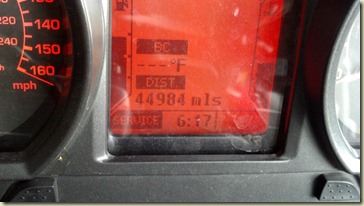
I got back to northern Virginia about 1800 on Monday, 8179 miles after I set out for Blairsville, Georgia.
Epilog
Miscellaneous
I’ve been to all 50 U.S. States over my lifetime – sometimes in a cage, sometimes by train, and sometimes by air (and rental car). I haven’t been to all that many by motorcycle (yet), and this trip helped fill in a lot of states (this is the complete list of states in which I rode over the period from 8 August through 20 August, including a lot that I’ve ridden through before):
Virginia
Kentucky
North Carolina
Georgia
Alabama
Mississippi
Louisiana
Arkansas
Missouri
Indiana
Illinois
Wisconsin
Minnesota
Michigan
Ohio
Kansas
Colorado
So, 17 states over 13 days…not too bad.
Lessons learned
Camping equipment – didn’t need it, and shouldn’t have packed it to begin with. Fortunately, I removed most of it before I left home.
Large bag – very nice to carry gear in, but didn’t need a bag this big for this trip.
Too much food on the bike – this is a lesson I’ve learned in backpacking, that I hadn’t applied (yet) to motorcycling. Also, when I need a quick bite, I can get it at most gas stations.
Time management – critical! I’m a big dawdler, even on rally time. This is something that I’ve got to continue to work on.
Food stops were extravagant – these need to be cut way back in the future. See time management, above.
Fuel stops were generally very good, with the exception of those that were tied to getting food.
Don’t plan while tired – this planning leads to mistakes that are hard to recover from. Leg 2 was plagued with this problem.
Follow the plan when developing on-the-road (tank bag) notes – route building on the fly was difficult, made more difficult because I couldn’t see my notes. I’m going to get another rally book mounting and reading system installed, as soon as Linda Tanner finishes my bag.
GPS – make sure the scale is correct coming up on a bonus location. Clinton library was difficult…too difficult. So was the cow plaque and the second TPM plaque.
Bonii in cities – GPS just plain doesn’t work in big cities like downtown Chicago. Need to plan route by hand, and follow the hand-written routing.
Beware of bonii in cemeteries, because access can be via goat trail – this is true for any route that may be considered “off road”.
Chip clips worked very well to hold the flag – they have an assigned place in the tank bag (as does the rally flag).
Camera worked great – made it the whole rally on one battery charge, but had a spare battery just in case. Others had a backup camera, just in case. I have my old rally camera that I can bring for that purpose.
Flashlights – only used one of the big hand-held auxiliary lights, not the other. If I’d done more night bonii, this situation would have been different.
Should have had electric jacket and controller. Was planning on unrelenting heat, and wound up with some pretty chilly (and sometimes wet) nights.
Left heated grip would have been nice – this is warranty work that needs to get done on the bike soon.
General stuff
Garmin Zumo 665 is unreliable when using SiriusXM – unit sometimes crashes (not sure of cause), and loses satellite radio connection / feed from time to time. Interaction with Android phone and SiriusXM radio problems? More experimentation necessary. It was really nice to have satellite weather, traffic, and music, though….
Conclusion.
I can hardly wait for our next rally – the Rendez-Vous in Quebec (and elsewhere).


